Showing posts with label travels in Mexico. Show all posts

Saturday, December 21, 2013

Traveling down the Transpeninsular, part 4

If you want to read the previous posts about this journey, here's part 1 and part 2 and part 3.

Boy, I'd never be able to be a professional writer, having to write every day. I'm good for about 3 days and then I need a break. But I've got one final installment of the Transpeninsular journey to share with you all. This was our last day on the road: Saturday. By mid-afternoon we'd be home! We started the morning driving for a couple of hours along the Sea of Cortez.

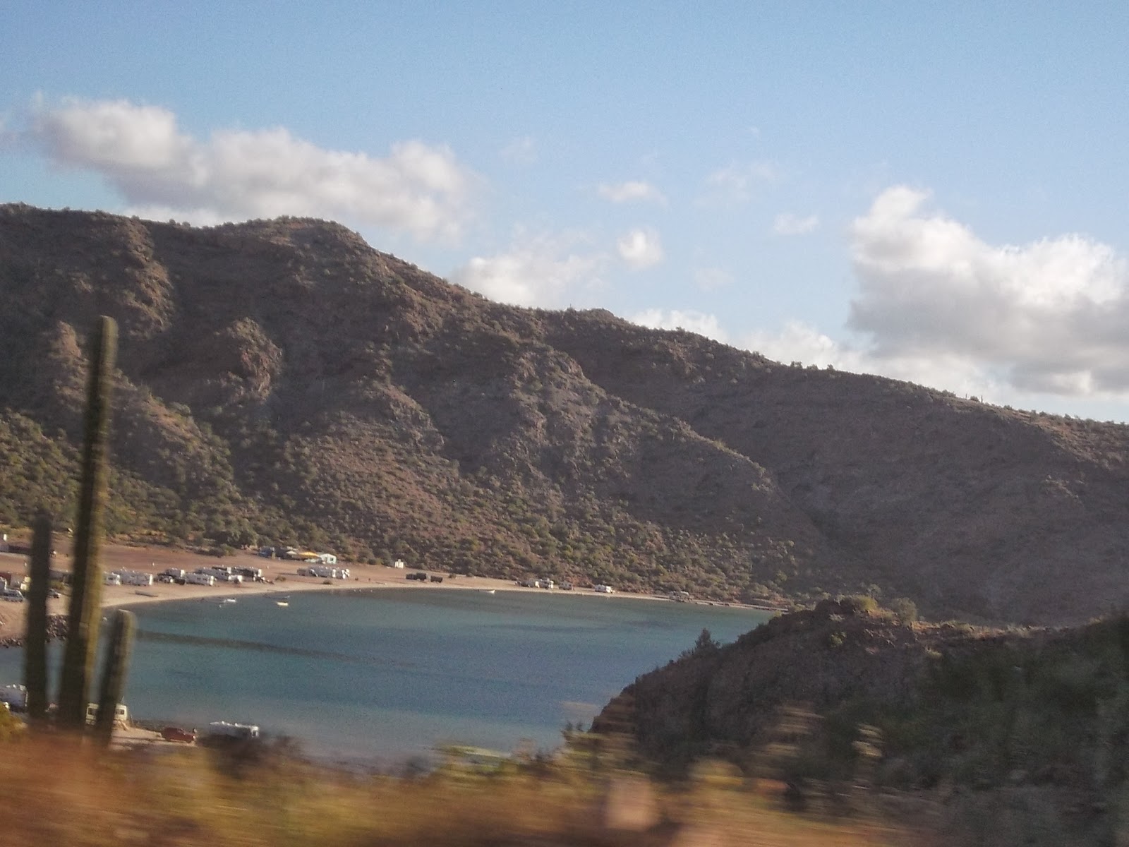
Mulege (where we stayed the night before) is at the head of a large bay, Bahia Concepcion, which has several campgrounds strung along its length, but no towns. If you click on the link you'll see that it is a favorite destination of many, mostly people with RV's since there aren't really any other facilities available.

Just driving along the bay evokes a deep sense of peace.

As you get nearer to Loreto, the site of the first mission in the entire chain of California missions, the Sierra Giganta range rises up on the right.

These mountains are expecially wondrous - the layers of mountains behind mountains is breathtakingly beautiful!


Although you can see plenty of cacti in the photos, this is primarily "deciduous tropical forest", marked by lots of small trees (mesquite, palo blanco, etc.) that lose their leaves in the spring and summer, when the weather is hot and dry, then grow them again in the fall after the summer storms.

Once out of the mountains the road is on a high plain which looks like the Central Valley of (Alta) California. It's HUGE, and the largest agricultural region of Baja Sur. There are dairy farms, corn, and citrus visible from the road, and other crops as well.


It takes about 2 hours to drive through the plain, and then the road begins a long descent down toward the Sea of Cortez (again) and the city of La Paz. On that too long stretch there is a small community with a shop that sells objects made by rancheros who live in the (very large) surrounding area. Here are a few of the things that caught my eye:

I especially like the table and chairs made with cowhide with some of the hair still on it. There's a bed behind them made the same way. The price isn't $6500, it's 6500 pesos (they use the same sign for money that we do), so about $550 US dollars. You can also see knife sheaths, but I didn't take a close-up of the actual hand-made knives that go with them. They've got intricate tracery on them - flowers and vines. Beautiful!

And that's as far as this photo journal goes. About 45 minutes after this stop on the road we got to La Paz and another hour later we were home, with enough daylight left to unpack everything. Then dinner at a new restaurant in town that specializes in Argentinean meat dishes. Yum!

Thursday, December 19, 2013

Traveling down the Transpeninsular, part 3

If you want to read the previous posts about this journey, here's part 1 and here's part 2.

The third day of our trip down the Baja peninsula started in a most enchanting place. Cataviña is truly in the middle of nowhere. It's 1 1/2 hours from the nearest gas station, and another 3 hours before the next one (if you're traveling south). There's no store, no church, nada. Just a hotel, Mexican style with the building surrounding lovely interior courtyards.

It's in the middle of the Boulder Fields. This whole region is filled with boulders, some as big as houses. Beautiful!

The small building in the photo above is a shrine, like the roadside shrines you see all along the highway, but it's behind the hotel.

What's so wonderful about this place is that the combination of small trees, cactus and boulders makes every view look like it was consciously landscaped.

Another thing - this area is where you start to see cirios (or boojums, to English speakers). There is nothing like these plants anywhere else in the world, and they grow only in the central part of the Baja peninsula. They're generally 10-20 feet high, but sometimes higher.

Strange, eh?

Well, we've got many miles to go, so I'll reluctantly leave our enchanted place behind. But if you'd like to know more about it, click here.

If you did happen to follow the last link, you might have read about the military checkpoints. I could do a whole post about the bad attitudes of Americans, but I'll leave it with a single comment. The soldiers at the checkpoints are incredibly polite. Every checkpoint has a sign in English explaining why they're there and saying what you should do if you're upset about how you're treated; and in our experience (which is considerable) the soldiers are consistently professional, treating people with respect, and they do not look for favors.

Here's a picture from one of the military checkpoints. Every one of them is well-kept, and maintained with pride. The soldiers landscape the areas along the road, and do a good job of it, too, with local plants and other objects (shells or bones or rocks laid out in interesting patterns, etc.)

If I remember correctly, in the entire 100 miles of the peninsula there are 5 checkpoints.

So, a mere 3 hours later, we've gone through the most desolate part of the peninsula which has almost no plants since it basically never rains there (this is around Guerrero Negro, at the border between Baja California and Baja California Sur). And after another 2 1/2 hours we're near the east coast of the peninsula, facing the Sea of Cortez. But first we need to past Tres Virgenes, a series of volcanos that last erupted in the mid-1700's so I think they're technically still active.

And finally we reach the Sea of Cortez and the town of Santa Rosalia. This is a historic mining town (copper) where there has been a working mine for about 130 years. The mine was recently re-opened using new technology and the town is booming.

Here's a photo of the old mine entrance, at the entrance to the town. At that point in its history it was an underground mine. The new mine is an open pit mine, not visible from the road.

We really like Santa Rosalia - it's got a unique ambience because it was built by the French - but we wanted to get a bit farther south this time, so we kept going another hour to Mulege. A pity, since this is - in our opinion - the worst tourist town on the peninsula, with a very creepy vibe to it. But if you love palm trees more than anything, Mulege is probably the town for you (if you don't mind horrible floods every few years).

However, we wanted to get home before dark the next day, so getting an hour further south was worth it. And this is where I'll leave you until tomorrow, when I'll post the last installment of the journey, where we pass some stunning mountains, the twin of the Central Valley of (Alta) California, and visit a shop that sells traditional rancho objects.

Until then, bendiciones!

Wednesday, December 18, 2013

Traveling down the Transpeninsular, part 2

If you want to start at the beginning, here is part 1 of this travel journal.

We were finally in Mexico, and it was the day of the Feast of Our Lady of Guadalupe. Unfortunately, we had to get on the road early, and the place we were heading to was so remote from anything that it has no church, so we knew that we were going to miss mass. However, God blessed us on the road, as you'll see.

But first we had to get out of Tecate. Here's a street in Tecate all decked out for Christmas - one of the only scenes there that I could find interesting enough to take a picture of.

Once past Tecate, you go through a valley in which they grow olives for olive oil.

Then came the wine country. This is the Valle de Guadalupe, which is sort of like driving back through time to Sonoma County in the 50's. We stayed at a B&B last year that was the house that the property owner grew up in, surrounded by acres of grapes. He told us that the Mexican government is actively encouraging the wine industry in this area and is giving low-interest loans for property owners to plant grapes, build wineries, etc.

There is a small community right on the highway (San Antonio) with a really nice shop selling local wines, cheeses, and olive oil, which we have decided is a "must stop" on the journey.

Then on through Ensenada. This is a big city, about a million people - interesting enough if you want to stop, which we didn't (although we have in the past). A short way past the city we came upon our first peregrinacion (a cabalgata) in honor Our Lady of Guadalupe.

One of the younger participants was riding a paint burro, which we had never seen before.

Then it was on through several small agricultural valleys.


This is one of the best parts of the journey, seeing the small ranchos and farms that form scattered communities, just as in the Midwest during the time of the Great Expansion. But the scenery is so much more varied than the Great Plains!

Onward through yet another wine area. This was the original area that the padres planted to make wine for the many missions up and down the peninsula.

This area is dominated by a couple of large companies, and the vineyards are massive. The round thing in the photo above is the roof of a new wine tasting room.
From time to time we passed corn fields ready to be harvested.

And here is a field of nopales (paddle cactus), which is not only one of the primary vegetables used in Mexico, but also one of the most nutritious things you can eat. And nopales are used for numerous medicinal purposes as well.

Then we got to the REAL agricultural region: the Valle de San Quintin. This is filled with miles of greenhouses growing all sorts of things, including berries. The area is right next to the coast and is usually cool and foggy, much like the coastal agricultural region south of San Francisco.

And at the end of the valley (actually a very wide coastal plain) we saw our second peregrinacion, but this one with dancers! There are a lot of migrant farm workers here, from poorer areas of Mexico, and this traditional dancing comes from one of the mainland areas.


Well, we were only halfway to our night's destination at that point, but I'm going to stop with one more photo. This is of the last agricultural area in Baja California (the state in the northern half of the peninsula). The major crops are beans and onions. All the fields are in a large river bed which actually floods every few years. The rest of the time the river, like most on the peninsula, is underground. God's clever that way - to keep the water from evaporating, He causes the rivers to flow under the surface, and thereby provides water to people, plants and animals.


Tomorrow: a most enchanted place, military checkpoints, the Sea of Cortez and more!

Tuesday, December 17, 2013

Traveling down the Transpeninsular, part 1

We may live far from our sons, and their families are far from each other, but we're all near the Pacific coast. This year is the first year I've had a camera to take photos of the road trip that we take each year to see our family. We go from the southern tip of the Baja peninsula all the way to Mendocino 1800 miles north of here (and back, of course!). It's a wondrous panorama that includes green desert, salt flats, chaparral, redwood forests, wine country, large cities, vast agricultural regions and views of mountains, the ocean and the Sea of Cortez. For the next 3 posts I'm going to show you the last section of the trip, from Santa Barbara south through the Baja peninsula.

We left Santa Barbara on Wednesday morning and took freeways that skirt the San Gabriel mountains and go east of the LA basin in order to miss the ever-horrible LA traffic. Although one would expect this part of the trip to be the easiest (due to uncrowded multi-lane freeways) it is actually the most exhausting. We always cross the border at Tecate, which is about 45 minutes east of San Diego, because the freeway ends in San Diego and from that point on there is a lovely country road (Highway 94) that takes you to the border.

There are a few horse farms along the route, and a couple of small communities. One of them is named Dulzura, which means "sweetness" in spanish.

One thing that we love about the mountains around Tecate is the boulders. These mountains look just like the ones surrounding Santa Barbara.


I've loved rocks all my life, ever since I took a geology class at the Junior Museum in Sacramento when I was nine. I've always wanted to have a house with a stone fireplace, or a stone foundation (which I now have). So every time we pass this boulder-rich area, my heart sings. "Bless the Lord, you mountains and hills; sing praise to Him and highly exalt Him forever." (Dan. 3:82)

It took 5 1/2 hours to get from Santa Barbara to Tecate. We stayed in a nice hotel/restaurant near the edge of town. It took me several years to find a decent hotel in Tecate. It's a working town - the Tecate beer plant is the largest employer, and there is also a Toyota plant there along with other manufacturers. Definitely NOT a charming town, but it's quite a bit smaller than Tijuana (about 65,000 people rather than a couple of million). But before we found out a good place to stay there, we would have to drive all the way to Ensenada to find a hotel, and that's another 2 1/2 hours. So now we make the first day of travel a short one, to rest up a bit after all the stress of driving in the U.S. And this hotel is the last place where I can be sure of an internet connection for the rest of the journey.

TOMORROW: Wine country, El dia de Nuestra Senora de Guadalupe, and farming in Baja.

Sunday, August 18, 2013

Gimme that old time religion

This is part 5 in a series.
For part 1, click HERE. For part 2, click HERE. For part 3, click HERE. For part 4, click HERE.

Padre was supposed to call us at about 10am so we could walk down to the street to meet him. I wasn't too worried when he hadn't called by 11 - we were all on vacation, after all - but I started praying that everything was all right with him. At 11:30 he called and said that the cough that he had started having on the way back from San Miguel the night before had become really bad, so he had driven home to Leon and had to have an injection of something and get some sleep. He said that he would pick us up at 1pm. We were going to end up in Guadalajara that night so we could fly home the next day.

We had agreed ahead of time that his mom and sister would come with us because we would be passing by a favorite shrine of his mom's, and he could also take her to visit relatives in Guadalajara. The shrine of Nuestra Senora de San Juan de los Lagos is a major focus of pilgrimages in central Mexico, and it was an amazing experience!

It's just like the descriptions of pilgrimage sites in the Middle Ages (my favorite era), with the streets surrounding the basilica filled with little tiendas.

I was particularly drawn to the ones that were selling crocheted items (there were quite a lot of them!), with the women crocheting goods to sell while waiting for customers.

When we entered the church, it was completely packed, and the central aisle was full of pilgrims walking on their knees to the the altar, where mass had just started. There is a mass every hour and a half at this church every day of the week, with the first one at 5:30 AM and the last one at 7:30 PM. Every one of them is apparently as packed as this one. Some pilgrims walk here from hundreds of miles away!

We found a place to stand along the side, and the entire time of the mass, more and more people kept coming in and walking past us to the front, or going on their knees down the central aisle. Since the church looked totally full when we came in, I have no idea where everybody found a place to put their bodies. I don't think I've EVER been in such a crowd in my life. When it was time for communion, there was no way that people could come up to the front, so we all just stood in rows in the main aisle and the servers came down the aisles and served us communion. I received from a tiny nun, surely only 4 1/2 feet tall - wonderful!

The Pirate did most of the driving (several hours worth) because Padre still was wiped out and his cough, although better, was quite worrisome. While we were on the road Padre told us that many people who go to that shrine go in fulfillment of a vow that they make to God if He answers a particular request of theirs. He called this an example of "popular religion", which although faith is present, an abiding relationship with God is often absent. The focus of popular religion is on what the person wants, not what God wants, and often the people who go on pilgrimage don't otherwise go to church or have any concept of spiritual growth. Of course, there are lots of people who go on pilgrimage who are serious about their relationship with God (a mixed crowd, just like in Canterbury Tales).

We stopped at another sanctuary to the martyrs of the Cristero war before heading on to Guadalajara, but I didn't get any photos (I was pretty tired at that point). When we got into Guadalajara it was dinnertime and we set out to find a particular restaurant that Padre had told us about which served Argentine-style (LOTS of different meats brought on skewers). It took us awhile to find the place, and when we got within a couple of blocks of it we saw most of the trees in the median strip of the road being cut up and hauled away. We found out that early that morning a huge tormenta (storm) had come through and knocked over 81 trees in the city, and flooded a bunch of homes as well! After dinner - a great treat for us all - Padre took us to our hotel and went with his family to a relative's house. We were on our own until we got on the airplane the next day.